Leica Geosystems and the Southern California Institute of Architecture Team up to Train the Architects of Tomorrow
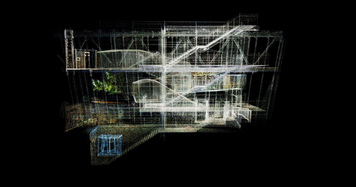
John Cooper for 'Views of Planet City.'
Today, Leica Geosystems, part of Hexagon, announces a new partnership with SCI-Arc, created to help train the next generation of architects. The partnership will enable students and faculty at SCI-Arc to experiment with advanced, user-friendly laser-scanning hardware and software, offering hands-on experience with intuitive reality capture solutions that will shape the future of architecture, landscape architecture, urban planning and design, media-based art and more.
“Architects are increasingly leveraging new technologies to create immersive projects, which means that students need to have access to innovative solutions to stay ahead of the curve,” said Fabio Ponzio, executive vice president at Leica Geosystems. “SCI-Arc has earned a reputation for preparing students for any eventuality, and we are honored to work alongside such inventive thinkers. Together, we can drive transformative progress in the media, entertainment and related design fields."
As part of the new partnership, Leica Geosystems is supplying SCI-Arc with over $200K of technology donations, including easy-to-use LiDAR scanners like the Leica BLK360 — a laser scanner that captures photorealistic 3D scans of areas, structures and objects — and the Leica BLK2GO — a handheld mobile scanner that can capture structures and complete layouts anywhere. Leica Geosystems will also sponsor a sizable sum in scholarships for postgraduate students in the EDGE program, which focuses on expanding the frontiers of architecture.
Views of Planet City.
Leica Geosystems’ laser scanning experts will actively share their deep knowledge and experience with the students, guiding them as they integrate these advanced solutions into their design workflows. Students are currently experimenting with Leica scanners to capture point cloud scans at the SCI-Arc campus and the SCI-Arc AltaSea incubator in San Pedro. Rather than relying on photogrammetry — which can force users to sacrifice accuracy — students can generate LiDAR scans to develop custom software for automating building design. From there, they can generate 2D site plans and build 3D models from text.
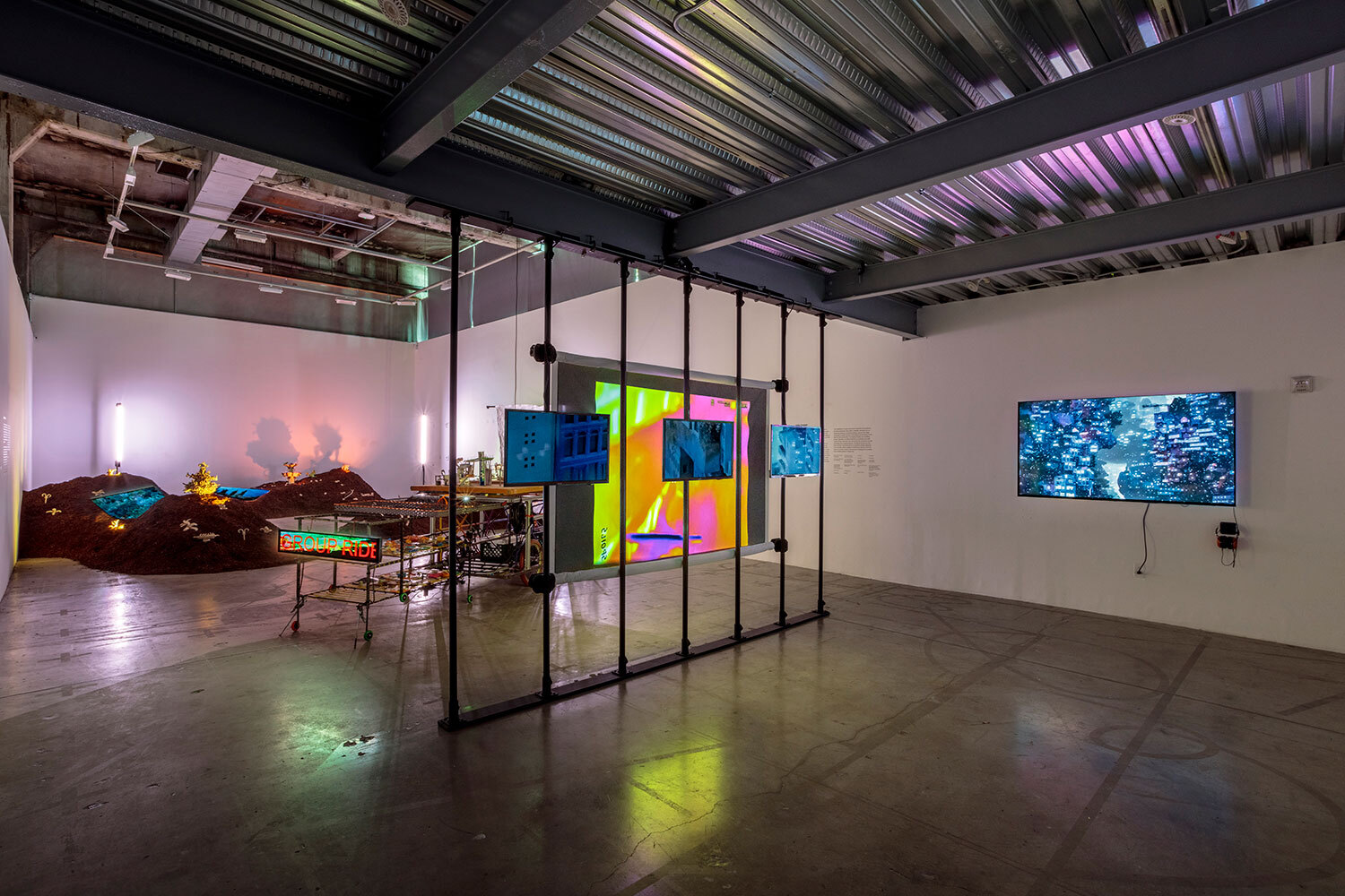
Students and researchers at SCI-Arc are already using Leica Geosystems technology in creative and forward-looking projects as well, beginning with the multi-year research and art exhibition, Views of Planet City.
Views of Planet City: Urban Foraging
Developed within the Getty Foundation’s cultural initiative “PST ART: Art and Science Collide,” Planet City examines what the world could look like if half the Earth were reserved for nature, and the 10 billion remaining humans retreated into a single megalopolis. To help design that incredible city, artist and SCI-Arc faculty John Cooper pioneered a new architectural look using “foraging” techniques to show what a city built around need, using only existing structures and materials, might look like.
Cooper's project within the exhibit, titled Planet City Spoils, offered a new aesthetic created from structures found around Los Angeles. Rather than digitally building 3D assets — which would have been prohibitively time-consuming — his team deployed a Leica BLK2GO scanner at chosen locations to capture a building’s structural make-up and materials. Each LiDAR scan was then added to a “shadow archive,” where artists could disassemble and reassemble scans to build digital and physical models using their chosen tools (including Cloud Compare, Rhino, Blender and Unreal Engine).

Angelica Lorenzi for 'Views of Planet City.'
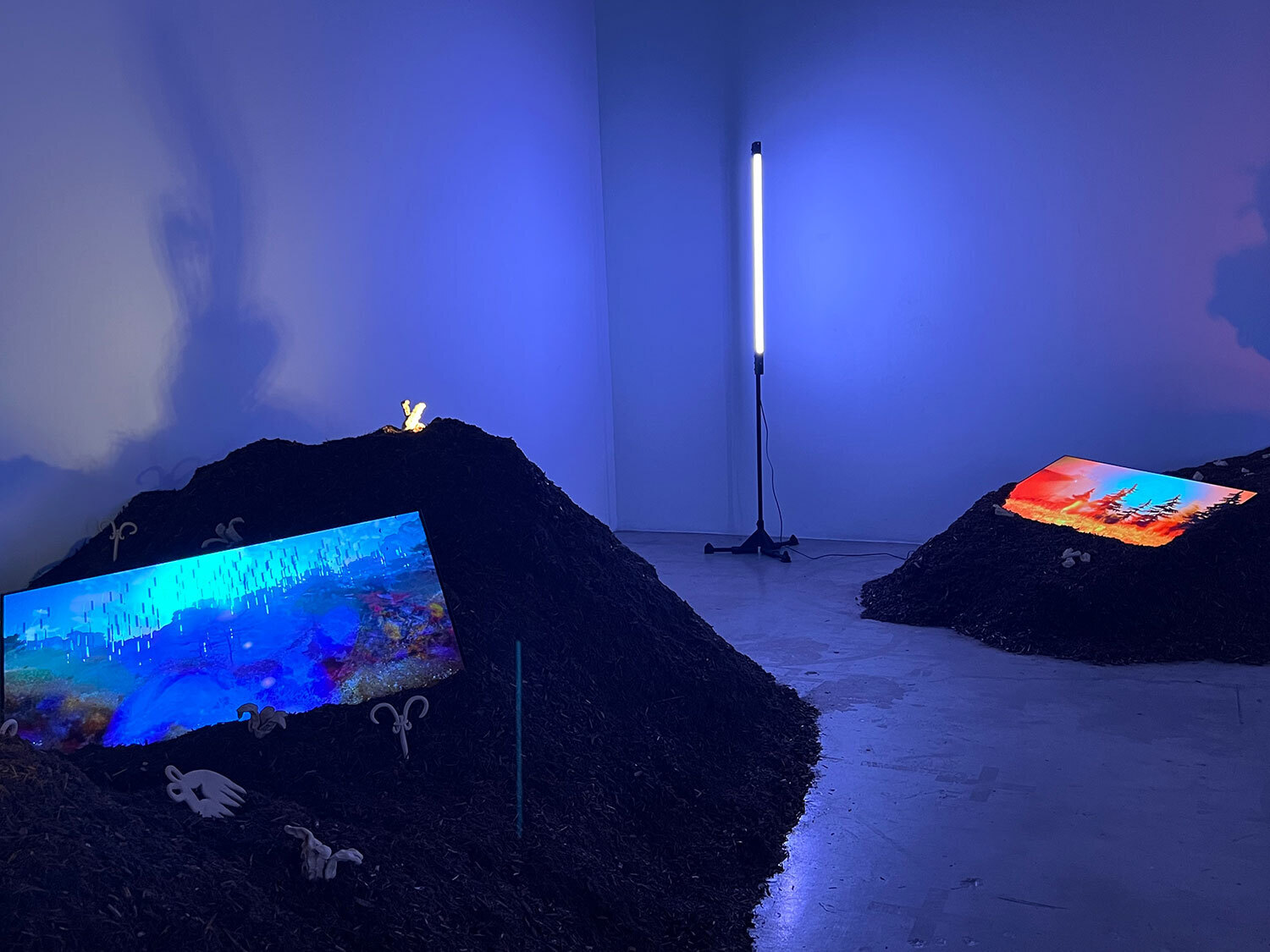
Views of Planet City: Scanning the Wilderness
While the Planet City megapolis offers an original look at a possible urban future, it also gives us a glimpse at what the rest of the world might look like untouched by human influence. In the associated multimedia project, Feral Planet, SCI-Arc faculty and artist Angelica Lorenzi set out to capture LiDAR scans of some of the most remote places in the world. Those scans then became the basis for a series of short films that dramatized the process of rewilding the uninhabited wilderness.
Lorenzi and a team of students traveled to the rocky coastal region of Piedra Blanca, California; the glacial mountains of Haines, Alaska; the densely forested high desert of McCoin Orchard, Oregon; and the UNESCO World Heritage Site of Monte Alban, Oaxaca. At each location they deployed a BLK360 to capture vegetation, geographic elements and the topography of each site. From there, the scans were uploaded and edited within Unreal Engine to create richly textured 3D assets, including animated models.
The Views of Planet City exhibit opened to the public in September 2024 and appeared at the Pacific Design Center Gallery through January 26, 2025. It remains on view at the SCI-Arc Gallery until February 16.
“The postgraduate programs at SCI-Arc EDGE broaden what an architect is capable of doing in the world by developing new knowledge and expertise,” said SCI-Arc postgraduate programs chair David Ruy. “Despite competing predictions about the future, direct experience with emerging technologies has always been the best crystal ball. I am thrilled to engage in this partnership and can’t emphasize enough how significant this relationship will be for our students and faculty.”
Angelica Lorenzi for 'Views of Planet City.'
About Leica Geosystems
With over 200 years of experience in precision measurement technologies, Leica Geosystems, part of Hexagon, designs precise and accurate laser scanning technology, sophisticated software and trusted services for various industries. Media and entertainment professionals in diverse disciplines such as VFX, virtual production, camera tracking, world building, projection mapping, and much more trust Leica Geosystems for all their laser scanning and reality capture needs. Known for premium products and innovative solution development, Leica Geosystems delivers value every day to those crafting their visions into reality.
Hexagon (Nasdaq Stockholm: HEXA B) has approximately 24,000 employees in 50 countries and net sales of approximately 5.2bn EUR. Learn more at hexagon.com and follow us @HexagonAB.